Moe Pass came by the other evening with coffee and a question. He had been reading trail signs up near the Mummy Range and wanted to know why the old maps called it something different. The Arapaho name, he said, had never come up in any of his ranger training. Nobody had told him about the White Owls.
I told him to sit down.
There is a version of this valley that most people walking its trails have never heard. Not the pioneer story. Not the hotel story. Not even the mining story. The one that came before all of those. The one where the names on every ridge and peak and high meadow are not labels but explanations. Where a mountain is not a mountain but a record of something that happened there, told in a language that was spoken here for centuries before anyone arrived with a surveying rod.
In 1914, two elderly Arapaho men came back to Estes Park for the first time since their childhood. They were brought by a woman from the Colorado Mountain Club who wanted the peaks named before the new national park was formalized. What those two men told her that summer is still sitting in the record, mostly unread.
Moe put down his coffee. "Why doesn't anyone talk about this?"
That is what I said.
PULL UP A CHAIR. THIS ONE'S GOOD.
The Names They Left on Everything
How the Arapaho mapped a sacred valley, and what two old men remembered in the summer of 1914
Who Were the Arapaho of Estes Park?
Before Joel Estes rode into the valley in 1859, before Lord Dunraven tried to buy it, before F.O. Stanley drove his steam car up the switchbacks, the people who knew this place best called it something else entirely.
In Arapaho, the Estes basin was known as "The Circle" — a reference to the shape of the valley and its central place in their world.
They were not casual visitors. The Northern Arapaho summered in what is now Rocky Mountain National Park at least through the 1850s. They hunted, camped, fought battles, and built a geography of meaning across the entire high country. Trails went by specific names. Peaks held specific stories. The land was not blank.
They were pushed out as settlers arrived. By the time the park was formally established in 1915, the Arapaho had been living on the Wind River Reservation in Wyoming for decades. Their names for this place had not made it onto any official map.
That almost did not change.
What Brought Two Old Men Back to the Valley in 1914?
In the summer of 1914, a woman named Miss Harriett W. Vaille was under pressure. She chaired the Nomenclature Committee of the Colorado Mountain Club. The Chief Geographer of the U.S. Geological Survey was pushing her to produce names for the features of the proposed national park. She could have invented them. She did not.
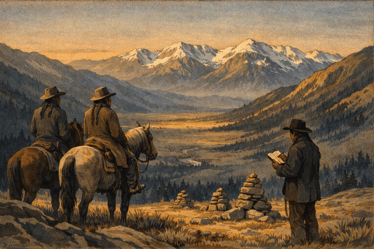
Instead, she traveled to the Wind River Reservation in Wyoming and persuaded two elderly Arapaho men to make the journey back to a place they had not seen since childhood.
Their names were Gun Griswold, age 73, a judge on the reservation, and Sherman Sage, age 63, the reservation's chief of police. They arrived at the Longmont train station on July 14, 1914, accompanied by Tom Crispin, a 38-year-old interpreter who was half Arapaho, half white, and well suited to the task.
A young Princeton student named David Hawkins came along to take notes. A local guide named Shep Husted led the horses. And a man named Oliver W. Toll, Miss Vaille's cousin, agreed to manage the whole expedition.
For two weeks, they rode. Past Poudre Lakes. Down the North Fork of the Colorado. Through Lulu City. By way of Flat Top and Hallett's Peak. They spent a night at Squeaky Bob's place on the Colorado. They visited the stone ruins of what local settlers had been calling "Indian Fort" near the Hondius Ranch.
Gun Griswold and Sherman Sage looked at those ruins and corrected the record. It was not an Indian fort in the general sense. It was the Apache Fort. The site of a specific battle, around 1855, when a party of fifty Apache arrived and clashed with the Arapaho across Beaver Park. Sherman Sage had been about four years old. He remembered it. He read the event from the stone markers the warriors had left, small and large piles placed according to custom to mark what happened where.
At the end of the trip, Toll and the three Arapaho men drove to the Agricultural College at Fort Collins and made dictaphone recordings of the Indian place names. The recordings sat in an archive. Most people driving Trail Ridge Road today have no idea any of this happened.
What Is Gianttrack Mountain?
High on the eastern ridge, there is a peak the Arapaho called hinenitee tohnooxeiht. It means, as directly as it can be translated: "where a person made tracks."
The story behind that name is short and has never been explained away.
Warriors traveling the ridge found footprints in the rock. Human footprints. The size of them was wrong. Too large. Much too large. The warriors looked at what was in front of them, and they turned around. They did not follow the tracks to see where they led.
That is the full account. No resolution. No explanation. No monster revealed and defeated. Just men who looked at something and decided the sensible response was to leave.
The name stayed. The mountain still carries it. If you have hiked that ridge and felt something uncomfortable about the scale of things up there, the Arapaho named that feeling a long time before you arrived.
What Did the Arapaho Believe About the Mummy Range?
The long ridge of pale rock that settlers called the Mummy Range for its silhouette had a different name and a different meaning in Arapaho tradition.
They called it nóókubéé3eino': White Owls.
In Arapaho belief, owls are not birds. They are ghosts. They represent night, cold, and winter. To name a mountain range after them is not decorative. It is explanatory.
According to the tradition Gun Griswold and Sherman Sage carried, the Mummy Range is the site of an ongoing battle between two powers: the White Owl, which represents night and winter, and the Thunderbird, which represents day and summer. The two have been fighting there since before anyone can remember.
Look at the range on the north side of Estes Park. Look at how much snow sits on it, and how long it stays. Look at what sits just to the west, a range that settlers named the Never Summer Mountains because the snow there never fully leaves.
The Arapaho explanation for why that part of the high country stays frozen most of the year is simple: the White Owl won.
Whether you read that as myth or as a remarkably accurate observation about regional snowpack and microclimate, the result is the same. The Arapaho named what they saw. They built a record of this place that lasted through displacement, through the establishment of a national park, through a century of tourism that mostly forgot they had ever been here.
What Did the Arapaho Know About Longs Peak?
The peak settlers named for Major Stephen H. Long, who spotted it from forty miles away and never actually approached it, was known to French trappers as Les Deux Oreilles, Two Ears, for the twin silhouette it cuts against the sky. The Arapaho knew the paired peaks as guides, landmarks that told you where you were from fifty miles in any direction.
On the summit, Gun Griswold's father, a noted warrior, hunter, and medicine man, had caught eagles many times over the years. The method was specific: he concealed himself near a stuffed coyote used as bait. When an eagle dropped to investigate, he grabbed it by the feet. The feathers were for war.
That summit was not a viewpoint. It was a working site. It had a specific use, a specific technique, and a specific man known for doing it well.
Before anybody climbed Longs Peak for the summit experience, someone was up there with a stuffed coyote.
What Happened to the Arapaho Names?
Some survived. Oliver Toll's report and the work of Louisa Ward Arps and Elinor Kingery, who compiled High Country Names, preserved a portion of what Griswold and Sage recorded in 1914. Trail Ridge Road follows, as Toll noted, practically the same route as the old Child's Trail. The Dog Trail up Fall River is named for the practice of using dogs to carry supplies.
Most of the names did not make it onto official maps. The peaks got English names. The ranges got English names. The trails got English names.
What remained is what two old men remembered on a two-week ride through their childhood, sixty years after they had last seen it.
The Circle is still the same shape it was. The White Owls still hold the north ridge. The tracks on hinenitee tohnooxeiht are still there, presumably.
Nobody has followed them yet.