February Never Looked This Good |
What two feet of May snow actually means for the valley, the river, the wildflowers, and the road |
 |
All winter, the numbers were bad.
Historically low snowpack. Some measurements calling it the worst on record for the season. Water managers doing math they did not want to do. River guides staring at flow projections and not saying much out loud.
Then May showed up.
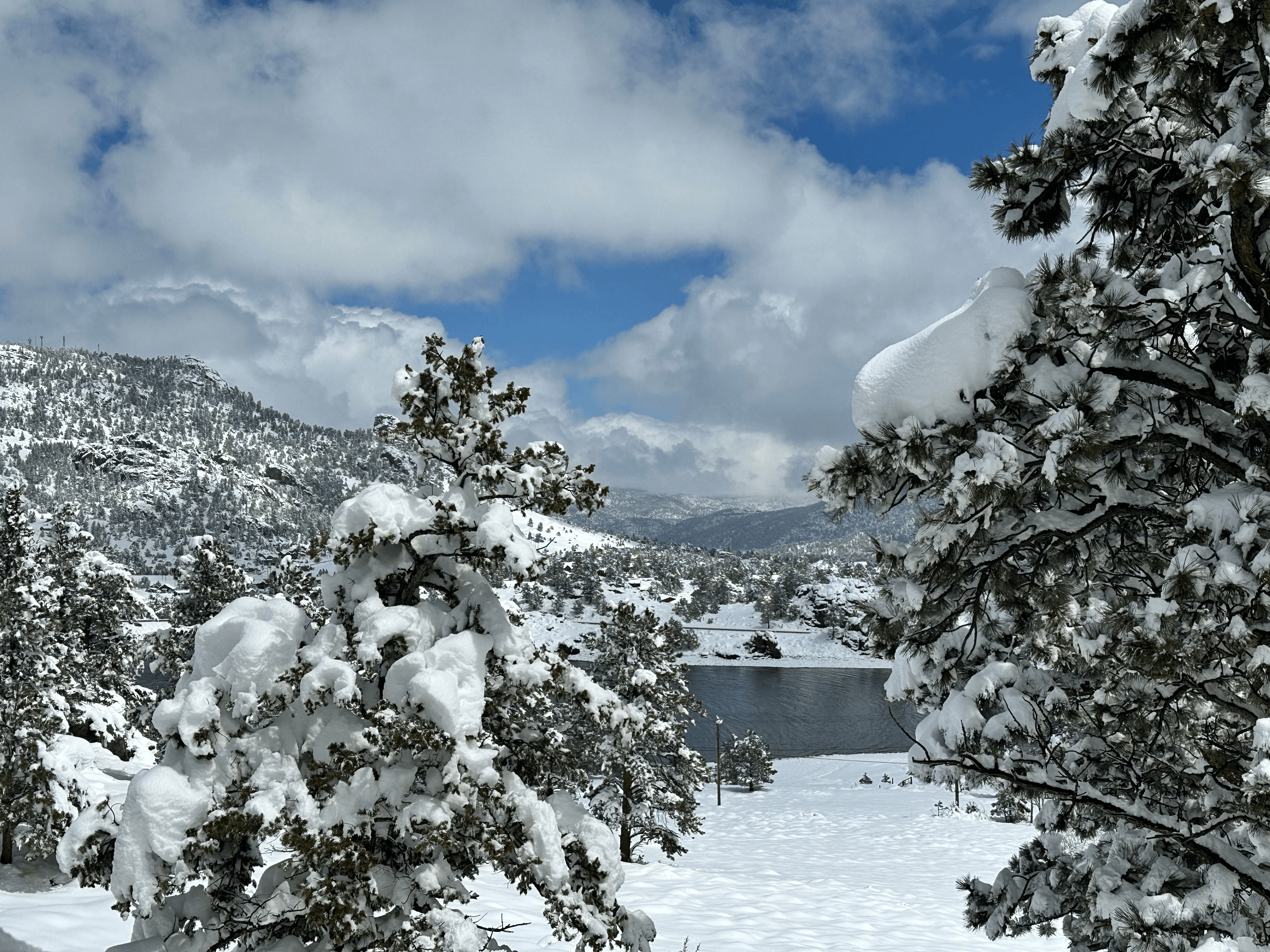
Roughly two feet of heavy wet snow fell across Estes Park and the surrounding foothills over two days. Some spots measured even more. The biggest May storm this part of Colorado has seen since 2003. After one of the weakest snow seasons in memory, the kind that makes old-timers go quiet when you ask about it, the mountains finally got something worth talking about.
One storm does not fix a whole winter. But this one changes the math.
The water.
May snow is different from January powder. Different in a way that matters.
January snow in Colorado is dry and light. A foot of it might contain an inch of actual water. You can pick it up with your hands and it weighs almost nothing. It is beautiful and it is mostly air.
May snow is not that.
May snow is heavy. Dense. Wet enough to snap branches and collapse carports and make you understand why the elk do not seem concerned about it. A foot of May snow contains considerably more water per inch than anything that fell in January. It will melt faster because the sun is higher and the days are longer. That part is true. But what it leaves behind in the watershed, what soaks into the ground and feeds the rivers and works its way through the system into June, matters more than the speed at which it disappears. Two feet of wet May snow is not the same as two feet of powder. Right now, that is a very good thing.
The wildflowers.
They were ahead of schedule. The thin snowpack had pushed the south-facing slopes into early bloom, the kind of compressed spring that looks beautiful for about ten days and then burns out fast. The May storm hit the reset button. The early bloomers got pushed back. The season will stagger now, opening in waves as the snow retreats elevation by elevation. Late May and early June are going to be worth getting outside for in ways that were not guaranteed a week ago.
The fire season.
Nobody likes to talk about this one in May. But a deeper snowpack at elevation delays the start of peak fire season in the high country. It buys time before the ground dries out and the grasses cure and the land managers start watching the forecast every morning. After the thin winter this valley had, any delay is worth having.
Trail Ridge Road.
Before the storm, the thin snowpack had people guessing an early opening. Maybe the earliest in years.
That calculation has changed.
Fresh snow on the upper road means more work for the plowing crews before anyone drives through. The road will open when it is ready. It always does. Call 970-586-1222 for current status or check nps.gov/romo. Do not plan around a date nobody has announced.
The elk.
They have been moving lower than usual all spring, following the snowline down to where the grass was coming in. The May storm pushed fresh snow down to elevations the winter never reached. Watch Moraine Park over the next two weeks. After a big storm the elk tend to move and feed actively, and the lower trails are open.
Moe wiped the snow off his boots at the door Thursday morning and said the valley looked like February out there.
I told him February never looked this good.
He did not argue. |